

How to get from São Paulo to Lagoa Santa (GO)
About 690 km and 9 to 10 hours by car, crossing inland São Paulo state and entering Goiás over the bridge on the Aporé River.
Updated on 2026-10-08
For those leaving São Paulo, Lagoa Santa is about 690 km and 9 to 10 hours away by car. The most common route crosses inland São Paulo state on the Anhanguera (SP-330) or Washington Luís (SP-310) highways, passes through Ribeirão Preto or São José do Rio Preto, enters Mato Grosso do Sul to Paranaíba (BR-158) and ends with about 75 km to the town, crossing the Aporé River on the Porto Alencastro Bridge, which marks the border with Goiás. As there is more than one possible combination of highways on the São Paulo stretch, confirm the route on your GPS before leaving.
Route summary
- Distance: approximately 690 km.
- Time: 9 to 10 hours of driving; with stops, 11 hours or more. Many people split it over two days.
- Highways: SP-330 (Anhanguera) or SP-310 (Washington Luís) in inland São Paulo, state highways to the border with MS, BR-158 to Paranaíba and the access to Lagoa Santa.
- Tolls: São Paulo's highways are under concession and have several toll plazas; budget for tolls (prices: check with the concessionaires). In MS and GO there are no tolls on the route (confirm).
- Fuel and food: Ribeirão Preto or São José do Rio Preto, towns in northwestern São Paulo state, Paranaíba.
Step by step, stretch by stretch
1. São Paulo to northern São Paulo state (SP-330 or SP-310, ~320 to 440 km)
Leave the capital on the Bandeirantes or Anhanguera highway. There are two main options, both dual carriageways well served by gas stations and restaurants:
- Via the Anhanguera (SP-330): Campinas, Limeira, Araras, Ribeirão Preto (about 315 km). Ribeirão Preto is the ideal lunch stop. From there, the GPS continues through northern São Paulo state toward the border with Mato Grosso do Sul.
- Via the Washington Luís (SP-310): along the Anhanguera to Cordeirópolis, then the SP-310 through Rio Claro, São Carlos, Araraquara and São José do Rio Preto (about 440 km). From Rio Preto, the GPS continues through northwestern São Paulo state to the bridge over the Paraná River.
The two routes are close in time. Choose based on the day's traffic and the stops you prefer.
2. Northern/northwestern São Paulo state to Paranaíba, MS (~175 to 300 km)
This is the stretch where the route varies and the GPS decides. The highways are no longer dual carriageways, traffic drops and so does the number of gas stations. Fill up in the last medium-sized town in inland São Paulo before continuing. Entering Mato Grosso do Sul and arriving in Paranaíba, on the BR-158, marks the end of the long part. Paranaíba has about 40,000 inhabitants, is the region's commercial hub and has gas stations, restaurants, hotels and supermarkets: it is the place for the last refuel and to sleep, if you split the trip.
3. Paranaíba to Lagoa Santa (~75 km)
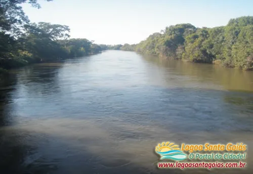
From Paranaíba, head toward Lagoa Santa on the road indicated by your GPS. The landmark is the Porto Alencastro Bridge, over the Aporé River, on the border between Mato Grosso do Sul and Goiás. On the other side, a few kilometers of single-lane road lead to the town. It is a stretch without major shops, with animals on the road at dusk; drive it in daylight.
| Stretch | Highway | Partial km (approx.) | Cumulative km (approx.) | Fuel / food |
|---|---|---|---|---|
| São Paulo → Ribeirão Preto or São José do Rio Preto | SP-330 or SP-310 | 315 to 440 | 315 to 440 | Campinas, Ribeirão Preto, Rio Preto |
| Inland São Paulo → Paranaíba, MS | state highways / BR-158 | 175 to 300 | ~615 | Towns in northern São Paulo state, Paranaíba |
| Paranaíba → Lagoa Santa | access via the Porto Alencastro Bridge | 75 | ~690 | Lagoa Santa (limited supply) |
Distances are approximate and depend on the route chosen in São Paulo state. Reference total distance: about 690 km. Confirm on your GPS.
Estimated fuel cost
Taking as a reference a car that does 12 km/L with gasoline at R$ 6.20 per liter, the 690 km use about 58 liters, approximately R$ 357 each way and R$ 713 round trip. Add the São Paulo highway tolls, which weigh on the budget for this route. These are estimates: fuel prices, actual consumption and toll rates change; redo the math with your car's data and the day of travel.
Split the trip over two days
Ten hours of driving with tolls and traffic leaving São Paulo are tiring. The most common overnight stops are Ribeirão Preto or São José do Rio Preto, in the first third, and Paranaíba, 75 km from your destination, which lets you reach Lagoa Santa in the morning and get into the lagoon the same day.
By bus or plane
- Plane: the reference airports are Goiânia (about 430 km from the town) and Campo Grande (about 470 km). Either way you need to rent a car and drive 6 to 7 hours; see from Goiânia and from Campo Grande. Leaving from São Paulo, driving directly is usually more practical.
- Bus: there is no direct line. You can go to Paranaíba, MS, or to Goiânia/Rio Verde and, from there, continue to Itajá (20 km from Lagoa Santa), with local transport at the end. Lagoa Santa bus station: (64) 3648-1439. Allow a full day or more.
Road safety tips
- Rain: from October to March summer downpours are heavy along the whole route; on single-lane roads, slow down and increase your following distance.
- Animals on the road: in Mato Grosso do Sul and on the final stretch in Goiás, cattle and wild animals cross the highway at dusk.
- Mobile signal: it drops on stretches in MS and between Paranaíba and Lagoa Santa. Download the offline map.
- Tolls: have an automatic payment tag or cash/card for the São Paulo toll plazas.
- Fuel: fill up in Paranaíba; in Lagoa Santa supply is limited.
- Emergencies in Lagoa Santa: Military Police (64) 3640-1147, HPS (64) 3640-1267. More on Useful phone numbers.
How many kilometers from São Paulo to Lagoa Santa (GO)?
About 690 km, 9 to 10 hours by car, through inland São Paulo state (Anhanguera or Washington Luís), Paranaíba, MS (BR-158) and the final 75 km to the town. Confirm the route on your GPS, as there is more than one combination of highways.
Isn't this the Lagoa Santa in Minas Gerais?
No. This is Lagoa Santa in Goiás, in the far south of the state, on the border with Mato Grosso do Sul, with a thermal lagoon at 31 °C. Lagoa Santa in Minas Gerais is in the Belo Horizonte region, about 1,000 km from here. See Lagoa Santa GO or MG?.
Is it worth flying and renting a car?
Rarely. The reference airports, Goiânia and Campo Grande, are 430 and 470 km from the town, which still means 6 to 7 hours on the road. Leaving from São Paulo, driving directly, with an overnight stop in Ribeirão Preto, Rio Preto or Paranaíba, is usually more practical.
Coming from far away? Book ahead
Hotels, guesthouses and holiday homes with phone and WhatsApp.